


For years my younger brother worked as a commercial airline pilot, and he told me that of all aviation hazards, a big thunderstorm struck him as the spookiest.
A convective thunderstorm develops when warm, moist, unstable air rises rapidly, cools, and condenses into towering cumulonimbus clouds. When the conditions are right, these clouds can grow from modest formations into enormous vertical structures reaching altitudes of 40,000 to 60,000 feet or more. Their defining characteristic is powerful vertical air movement, which can generate extreme turbulence, hail, lightning, icing, and violent changes in wind speed and direction.
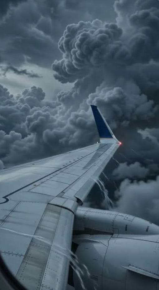
The process begins when solar heating, converging winds, or an advancing weather front forces warm, humid air upward. As the air rises and cools, water vapor condenses, releasing latent heat that further increases the updraft. This positive feedback can produce extraordinarily powerful updrafts, sometimes exceeding 100 miles per hour. Within a mature convective cell, ascending currents coexist with descending currents of precipitation-cooled air, creating an unstable environment of rapidly changing aerodynamic forces.
For an approaching aircraft, the immediate danger is severe turbulence, including sudden transitions between powerful updrafts and downdrafts. These vertical air currents can produce abrupt changes in altitude, airspeed, and angle of attack, potentially exceeding the aircraft’s structural load limits. Especially dangerous are situations in which an aircraft is rapidly accelerated upward and then downward, subjecting its wings and fuselage to alternating stresses. In extreme circumstances, these forces can cause structural failure.
My brother has a buddy who, in his youth, flew for the Czechoslovak Air Force and who claimed to have once flown a MiG-21 directly through a large cell—just for kicks. He instantly regretted it as the aircraft was subjected to extraordinarily violent aerodynamic forces, and for a moment he thought the plane was going to break up.
Another hazard is the formation of hail within the storm. Strong updrafts repeatedly carry water droplets above the freezing level, where they accumulate successive layers of ice. Large hailstones can remain suspended until their weight exceeds the supporting force of the updraft. When they fall, they can severely damage windshields, wings, engines, and other aircraft components. Hail may also be expelled from the storm’s central updraft region and encountered outside the visible cloud, sometimes many miles from its core.
Convective cells also create dangerous icing conditions. Supercooled water droplets can remain liquid at temperatures well below freezing and freeze rapidly upon contact with an aircraft. Ice accumulation changes the aerodynamic shape of wings, increases drag, reduces lift, and can interfere with sensors and control surfaces. Although many aircraft possess sophisticated anti-icing systems, these systems are not always capable of protecting against the most extreme icing conditions encountered in deep convection.
Pilots approaching an area of convective weather must consider how rapidly a cell can develop upward. A cell whose cloud tops initially appear to be at 30,000 feet can grow thousands of feet within minutes, potentially overtaking an aircraft attempting to fly above it.
Moreover, the visible cloud top does not necessarily mark the upper boundary of hazardous turbulence. Powerful updrafts can overshoot the surrounding atmospheric stability layer, producing overshooting tops and turbulence above the main anvil. Consequently, attempting to overfly a developing thunderstorm can be considerably more dangerous than its apparent height initially suggests.
At high altitude, these hazards can be compounded by the relatively narrow operating envelope of jet aircraft. Near their service ceilings, the margin between low-speed buffet and high-speed compressibility effects becomes smaller.
A sudden convective updraft or downdraft can alter the aircraft’s angle of attack and airspeed, potentially bringing it close to aerodynamic stall or high-speed buffet. This narrowing of the safe speed range is commonly associated with the phenomenon known as coffin corner. Severe turbulence can therefore present exceptional control challenges for aircraft operating near their maximum certified altitudes. This particular hazard may have played a role in November 1, 2026 crash of the Learjet 60 in Florida.
For these reasons, aviation practice emphasizes lateral avoidance rather than attempting to climb over intense convective thunderstorms. FAA guidance generally recommends avoiding severe or intense thunderstorm echoes by at least 20 miles, recognizing that dangerous turbulence and hail can extend well beyond the visible cloud boundaries.
My understanding is that any commercial aircraft would have gone around that storm system. One has to wonder if the pilots were fully aware of the risks of trying to fly over. Such a shame for a bright young promising pilot to come to that end, and likewise for the family and souls aboard.
Life is uncertain. There are few guarantees, but one guarantee is that eventually we all pass from this life. Live right, live well, and try to use your given time to make life better for others.
there's old pilots; and there's bold pilots;
but seems there ain't old, bold pilots .......